_Evolution of the Web

_Introducing GeoCAT

_GeoCAT!

_CSS3
CSS3 new options
Box-shadow
Background gradients
...
_Canvas
Using Canvas on markers
Custom OverlayView in Gmaps v3, Leaflet, OSM,...
...
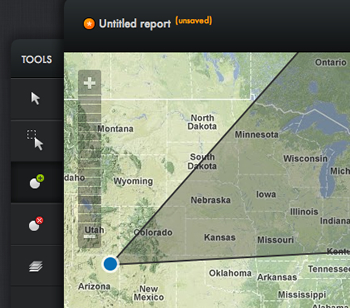
_Layers
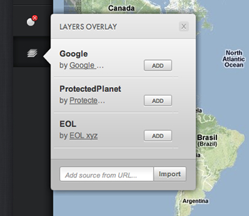
Add/remove
Hide/show
Sort
... layers in the map
_Visual Raster


→


_Imazon

_OMT -> Web workers
Asynchronous - "Additional threads not blocking user-interface"
Server side vs client side for georeferencing
/
#